All countries of the world listed from A-Z:

or choose from the countries per continent below:


 |  |  |  |  |  |
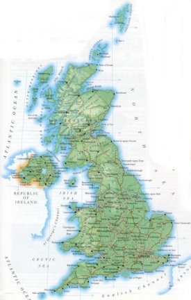 | The UNITED KINGDOM of Great Britain & Northern Ireland[Great Britain & Northern Ireland] : |
| General useful information |
| Note: some data are of constant value, while other are due to changes, fluctuations etc. |
| Nation and population |
| official name (short form): United Kingdom ; United Kingdom of Great Britain and Northern Ireland |
| country code ISO: GB //; - FIPS: UK |
| location: West Europe |
| time zone: +0 UT* [*= applying daylight saving time] |
| surface (land) area: 241600 sq.km = 93282 sq.mi //; - area incl. inland waters: 244880 sq.km = 94548 sq.mi |
| geographical position in extreme co-ordinates: North: / South: / East: / West: |
| borders (land): Ireland |
| borders (coastline): North Sea, Atlantic Ocean, Irish Sea, English Channel |
| climate: mild temperate maritime |
| Government |
| independent since: 1066-10-14 ; 1921 |
| type of government: constitutional monarchy |
| capital: London |
| administrative division: county, district, island area, metropolitan county, region, bailiwick, crown dependency: in total 95 |
| Population |
| population according to the latest census (1991): 56467,000 |
| total population according to the estimate of midyear 2000: 59511,464 /-; 2001: 59647,790 |
| population density: 247 per sq.km = per 639 sq.mi |
| population growth: 0,2% //; - doubling time: not applicable, exceeds 100 years |
| birth rate: 12 - 14 per 1000 |
| death rate: 10 - 12 per 1000 |
| fertility rate: 2 children per female |
| maternal mortality: 9 per 100,000 |
| infant mortality (1-4 years): 9 per 1000 |
| life expectancy: 78 years (male: 75; female: 81) |
| age breakdown: 0-14 years: 19% //; - 15-59 years: 61% //; - 60+ years: 21% |
| urbanisation: 89,5% //; - urbanisation growth: 0,3% |
| percentage of urban population in the greatest city: 20% |
| Ethnic composition, language, religion |
| ethnic groups: white 95% (English 81,5%; Scottish 9,6%; Irish 2,4%; Welsh 1,9%); Asian Indian 1%; West Indian 1%; Pakistani 1% |
| languages: English, Welsh, Scottish, Gaelic |
| religious affiliation: Anglican 44%; Roman Catholic 10%; Presbyterian 7%; Methodist 4%; Baptist 1%; Muslim 1%; non-religious 31% |
| Health |
| daily food intake: 3257 calories per capita |
| population with access to safe water: 100% |
| people per physician: 1719 |
| people per hospital bed: |
| Education, literacy |
| school enrolment: primary education 6-11 years: 100% |
| school enrolment: secondary education: 82% |
| school enrolment: tertiary education 20-24 years: 24% |
| adult literacy: virtually 100% (male: %; female: %) |
| Economy and infrastructure |
| Economy and trade |
| currency: Pound sterling = 100 new pence |
| annual inflation rate: 3% |
| population below poverty line: 15% |
| Gross Domestic Product: USD 18700 per capita |
| GNI USD 24430 per capita //; - [ppp: 23550] |
| GDP growth: 2% |
| income: USD 16750 per capita |
| import: USD 287529 per capita //; - export: USD 261950 per capita |
| trade: USD 7140 per capita //; - or 44% of GDP |
| trade partners: DE US FR NL ES EI JP IT SE CH CA |
| human development index: 0,923 //; - position of the country in the world no.: 14 |
| female labour force: 44% |
| unemployment: 5.5% |
| tourism: 25 million |
| Economic activities in agriculture, fisheries, industry, mining, services, energy |
| land use: arable land: 28% //; - grass land: 46% //; - wooded area: 10% //; - arid land and desert: ca 10% |
| agriculture: labour force: 2% //; - part of agriculture in GDP: 2% |
| agricultural products: wheat, sugar beets, barley, potatoes, rapeseed, cabbage, carrots, oats, oilseeds, vegetables |
| livestock (million): cattle: 11,1 / horses: 0,2 / pigs: 6,5 / poultry: 170 / sheep: 42,3 |
| fish catch: 837000 - 1030000 metric tonnes |
| industry: labour force: 20% //; - part of industry in GDP: 37% |
| industrial products: scala of diverse products: food, chemicals, electrical, chemical, metal, transport |
| mining products: limestone, iron, tin, lead, coal, natural gas & oil, salt, clay |
| CO2 emission per capita: 9,2 |
| services: labour force: 78% //; - part of services in GDP: 61% |
| energy use (kg per capita): 3871 |
| electricity use (per capita): 5384 |
| annual water use (per capita): 205 |
| Traffic, communication |
| road network: 356517 km //; - of which paved: 100% //; - of which are motorways: 3422 km |
| vehicles: 367 per 1000 |
| railways: 16583, or 37849 km //; - railways passenger/km: 29216 |
| navigable inland waterways: 1135, or 3200 km |
| ownership telephone: 502 - 567 per 1000 |
| ownership radio receivers: 1109 - 1452 per 1000 |
| ownership tv-sets: 524 - 641 per 1000 |
| newspaper circulation: 351 per 1000 |
| persons per post office: |
| personal computers: 338 per 1000 |
| Some physical landmarks |
| mountains: Ben Nevis 1343 m, Ben Macdui 1309, Ben Lawers 1214, Carn Eige 1182, Ben More 1174 |
| lowest point: sea level |
| lakes (natural): Lough Neagh 396 sq.km, Lower Lough Erne, Loch Ness, Loch Lomond and a lot more smaller lakes |
| lakes (artificial reservoirs): possibly some small ones |
| lakes (deepest): Loch Morar 310 m |
| rivers: Severn 354 km, Thames, Avon, Humber, Ouse, Tees, Tyne, Trent, Tay |
| canals: some canals between several rivers |
| waterfalls: Eas a'Chual Aluinn from Glas Bheinn, 200 m |
| caves: longest system: / deepest: Ogof Ffynnon Ddu 308 m |
| islands: the state itself consists of islands, bigger and smaller ones |
| deserts: none |
| other natural features: most northerly point of the British mainland: Dunnet Head, north-east Scotland / most southerly: Lizard Point, Cornwall |
| Additional remarks, especially on the statistical information |
| other important features: |
| apart from physical landmarks most of the above figures are changeable, in most cases they date from the 1990's |
| primary sources used for the general information: |
| BB CA EV PW WA WB WR, and some national statistical yearbooks |
| particulars concerning population data: |
 To the page containing the population growth statistics of the country
 To the page containing urban historical population statistics
 Back to the homepage of this website: POPULATION STATISTICS
Internet website: Internet website:Latest modification of this page on 2004-03-13 by Jan Lahmeyer
© "populstat" site: Jan Lahmeyer
 To the page containing the historical population growth statistics of the adminstrative division, prior to 1974