All countries of the world listed from A-Z:

or choose from the countries per continent below:


 |  |  |  |  |  |
 | FRANCEgeneral data of the country |
| General useful information |
| Note: some data are of constant value, while other are due to changes, fluctuations etc. |
| Nation and population |
| official name (short form): France |
| country code ISO: FR //; - FIPS: FR |
| location: Western Europe |
| time zone: +1 UT* [*= applying daylight saving time] |
| surface (land) area: 551500 sq.km = 212934 sq.mi //; - area incl. inland waters: sq.km = sq.mi |
| geographical position in extreme co-ordinates: North: 51° N / South: 42° N / East: 8° E / West: 5° W |
| borders (land): Belgium, Luxembourg, Germany, Switzerland, Italy, Monaco, Spain, Andorra |
| borders (coastline): Atlantic Ocean, Mediterranean Sea |
| climate: varies regionally: maritime, alpine, mediterranean |
| Government |
| independent since: 843-08 ; 1685 |
| type of government: republic |
| capital: Paris |
| administrative division: département (95) |
| Population |
| population according to the last two censuses (1991): 56565,900 //; - (1999): 58518,748 |
| total population according to the estimate of midyear 2000: 58892,000 // - ; 2001: 58870,000 |
| population density: 107 per sq.km = 277 per sq.mi |
| population growth: 0,5% //; - doubling time: not applicable, exceeds 100 years |
| birth rate: 12 - 13 per 1000 |
| death rate: 9 - 10 per 1000 |
| fertility rate: 2 children per female |
| maternal mortality: 14 per 100,000 |
| infant mortality (1-4 years): 7 - 8 per 1000 |
| life expectancy: 79 years (male: 75; female: 83) |
| age breakdown: 0-14 years: 20% //; - 15-59 years: 61% //; - 60+ years: 19% |
| urbanisation: 76% //; - urbanisation growth: 1,4% |
| percentage of urban population in the greatest city: 23% |
| Ethnic composition, language, religion |
| ethnic groups: French 92%; Arab/North African 4%; German 2%; Breton 1%; Catalan 1% |
| languages: French, Arabic; from other minorities: Breton, Catalan, Basque, Corsican, German, Flemish |
| religious affiliation: Roman Catholic 76%; other Christian 4%; Muslim 6%; Jewish 1%; non religious 14% |
| Health |
| daily food intake: 3541 calories per capita |
| population with access to safe water: 100% |
| people per physician: 343 |
| people per hospital bed: 89 |
| Education, literacy |
| school enrolment: primary education 6-11 years: 100% |
| school enrolment: secondary education: 97% |
| school enrolment: tertiary education 20-24 years: 35% |
| adult literacy: 99% (male: %; female: %) |
| Economy and infrastructure |
| Economy and trade |
| currency: Euro = 100 cents (until 2002: Franc = 100 centimes) |
| annual inflation rate: 1,5% |
| population below poverty line: 11% |
| Gross Domestic Product: USD 25000 per capita |
| GNI USD 24090 per capita //; - [ppp: 24420] |
| GDP growth: 1,4% |
| income: USD 20600 per capita |
| import: USD 273387 per capita //; - export: USD 284046 per capita |
| trade: USD 8195 per capita //; - or 47% of GDP |
| trade partners: DE IT BE GB US ES NL JP |
| human development index: 0,924 //; - position of the country in the world no.: 13 |
| female labour force: 45% |
| unemployment: 10% |
| tourism: 75 million |
| Economic activities in agriculture, fisheries, industry, mining, services, energy |
| land use: arable land: 35% //; - grass land: 21% //; - wooded area: 27% //; - arid land and desert: % |
| agriculture: labour force: 7% //; - part of agriculture in GDP: 3% |
| agricultural products: cereals, fruit, vegetables, winegrapes, sugarbeets, potatoes, timber, dairy, fish |
| livestock (million): asses: 0,02 / cattle: 21 / goats: 1 / horses: 0,3 / pigs: 15 / poultry: 299 / sheep: 10 |
| fish catch: 578071 - 829914 metric tonnes |
| industry: labour force: 20% //; - part of industry in GDP: 29% |
| industrial products: machinery, automobiles, steel, chemicals, wine, textiles, perfumery, aircraft, electronics |
| mining products: coal, natural gas, iron, zinc, bauxite |
| CO2 emission per capita: 6,3 |
| services: labour force: 74% //; - part of services in GDP: 68% |
| energy use (kg per capita): 4351 |
| electricity use (per capita): 6392 |
| annual water use (per capita): 665 |
| Traffic, communication |
| road network: 804450 km //; - of which paved: 92% //; - of which are motorways: 9626 km |
| vehicles: 421 per 1000 |
| railways: 31940 km //; - railways passenger/km: 55470 |
| navigable inland waterways: 5524 - 14932 km |
| ownership telephone: 558 - 582 per 1000 |
| ownership radio receivers: 862 - 943 per 1000 |
| ownership tv-sets: 579 - 623 per 1000 |
| newspaper circulation: 237 per 1000 |
| persons per post office: 3440 |
| personal computers: 304 per 1000 |
| Some physical landmarks |
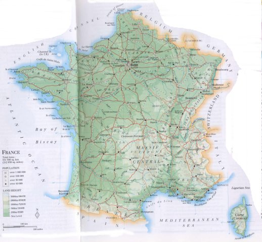
| mountains: Mont Blanc 4807 m, Mt. Maudit 4465, Dôme du Goûter 4304, Mt. Blanc du Tacul 4248, Aiguille Verte 4122 |
| lowest point: sea level |
| lakes (natural): Lac d'Annecy, amongst a number of relatively small scattered lakes |
| lakes (artificial reservoirs): a number of relatively small artificial lakes |
| lakes (deepest): unknown |
| rivers: Loire, Seine, Marne, Yonne, Rhône, Saône, Garonne, Lot, Somme, Meuse, Moselle, Durance |
| canals: Canal du Midi, several linking canals between the rivers Seine, Marne, Meuse, Loire, Rhône |
| waterfalls: unknown |
| caves: longest system: unknown / deepest: |
| islands (excl. overseas departements): Corsica, Île d'Oléron, Île de Ré, Belle Île, Îles de Hyères |
| deserts: none |
| other natural features: |
| Additional remarks, especially on the statistical information |
| other important features: |
| apart from physical landmarks most of the above figures are changeable, in most cases they date from the 1990's |
| primary sources used for the general information: |
| BB CA EV PW WA WB WR, and some national statistical yearbooks |
| particulars concerning population data: |
 To the page containing the population growth statistics of the country
 To the page containing historical population statistics of the administrative division: departments
To the page containing urban historical population statistics
 Back to the homepage of this website: POPULATION STATISTICS
Internet website: Internet website:Latest modification of this page on 2004-02-10 by Jan Lahmeyer
© "populstat" site: Jan Lahmeyer