All countries of the world listed from A-Z:

or choose from the countries per continent below:


 |  |  |  |  |  |
 | BELARUSgeneral data of the country |
| General useful information |
| Note: some data are of constant value, while other are due to changes, fluctuations etc. |
| Nation and population |
| official name (short form): Belarus |
| country code ISO: BY [BLR] //; - FIPS: BO |
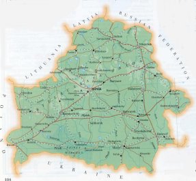
| location: Eastern Europe |
| time zone: +2 UT* [*= applying daylight saving time] |
| surface (land) area: 207595 sq.km = 80155 sq.mi //; - area incl. inland waters: sq.km = sq.mi |
| geographical position in extreme co-ordinates: North: 56° 10' N / South: 51° 16' N / East: 32° 47' E / West: 23° 11' E |
| borders (land): Russian Federation, Ukraine, Poland, Lithuania, Latvia |
| borders (coastline): none |
| climate: moderate continental |
| Government |
| independent since: 1991-08-26 [1990-07-27 ; proclamation 1991-08-25] |
| type of government: republic |
| capital: Mensk (Minsk) |
| administrative division: oblast (6); and these into rajon (100) |
| Population |
| population according to the last two censuses: (1989) 10199,709 //; - (1999): 10045,237 |
| total population according to the estimate of midyear 2000: 10366,719 //; or: 10005,000; 2001: 9955,000 //; 2002: 9925,000 |
| population density: 48 per sq.km = 125 per sq.mi |
| population growth: -0,1% //; - doubling time: not appicable; deminishing population |
| birth rate: 11 - 15 per 1000 |
| death rate: 13 per 1000 |
| fertility rate: 2 children per female |
| maternal mortality: 13 per 100,000 |
| infant mortality (in the first year of life): 20 per 1000 |
| infant mortality (from 1st - 4th year of life): 12 - 17 per 1000 |
| life expectancy: 70 years (male: 64; female: 75) |
| age breakdown: 0-14 years: 23% //; - 15-59 years: 60% //; - 60+ years: 17% |
| urbanisation: 71% //; - urbanisation growth: % |
| percentage of urban population in the greatest city: % |
| Ethnic composition, language, religion |
| ethnic groups: Byelarussian 78% [81]; Russian 13% [11]; Polish 4%; Ukrainian 3% [2]; Jewish 1% |
| languages: Belorussian 70 [78]%; Russian 25% |
| religious affiliation: Belorussian Orthodox 60%; Roman Catholic 8%; Evangelical Protestant, Jewish, Uniate, Muslim |
| Health |
| daily food intake: 3136 calories per capita |
| population with access to safe water: 100% |
| people per physician: 219 - 224 |
| people per hospital bed: 81 |
| Education, literacy |
| school enrolment: primary education 6-11 years: 100% |
| school enrolment: secondary education: 76% [84%] |
| school enrolment: tertiary education 20-24 years: 10% |
| adult literacy: 99% (male: 99%; female: 99%) |
| Economy and infrastructure |
| Economy and trade |
| currency: Zaichik [or: Belarus Rubel? (BYR)] = 100 kopecks |
| annual inflation rate: 335% |
| population below poverty line: 42% |
| Gross Domestic Product: USD 2620 - 3117 per capita |
| GNI USD 1360 - 2870 per capita //; - [ppp: 5500 - 7550] |
| GDP growth: -1,4% |
| income: USD 3110 per capita |
| import: USD 5564 per capita //; - export: USD 4707 per capita |
| trade: USD 1000 - 6458 per capita //; - or 53% of GDP |
| trade partners: RU (CIS) UA DE PL IT US |
| human development index: 0,782 //; - position of the country in the world no.: 53 |
| female labour force: 49% |
| unemployment: 2 - 3% |
| tourism: 0,4 million |
| Economic activities in agriculture, fisheries, industry, mining, services, energy |
| land use: arable land: 45 [- 50]% //; - grass land: 15% //; - wooded area: 33 [- 39]% //; - arid land and desert: % |
| agriculture: labour force: 13-20% //; - part of agriculture in GDP: 26% [PG 1998: 17% ; FW 2002: 11%] |
| agricultural products: flax, cereals, potatoes, dairying, pigs, peat |
| livestock (1000s): cattle: 4080 - 4326 / goats: 58 / horses: 215 / pigs: 3370 - 3566 / poultry: 30600 - 33000 / sheep: 92 |
| fish catch: 450 - 7269 metric tonnes |
| industry: labour force: 31-35% //; - part of industry in GDP: 56% [PG 1998: 54% ; FW 2002: 37%] |
| industrial products: electrical equipment, engineering, steel, chemical fibers, textiles |
| mining products: natural gas, coal, rock salts, potassium |
| CO2 emission per capita: 6,0 |
| services: labour force: 50-51% //; - part of services in GDP: 18% [PG 1998: 29% ; FW 2002: 52%] |
| energy use (kg per capita): 2381 |
| electricity use (per capita): 2704 |
| annual water use (per capita): 205 |
| Traffic, communication |
| road network: 63355, or acc. to other sources: 265600 km (66203) //; - of which paved: 89% //; - of which are motorways: 0 km |
| vehicles: 68 - 145 per 1000 // international license plate: BY |
| railways: 5512 - 5590 km //; - railways passenger/km: 12505 |
| navigable inland waterways: 1757 km |
| ownership telephone: 190 - 280 per 1000 // international dialling code: +375 |
| ownership radio receivers: 311 per 1000 |
| ownership tv-sets: 265 per 1000 |
| newspaper circulation: 187 per 1000 |
| persons per post office: 2650 |
| personal computers: per 1000 |
| Some physical landmarks |
| mountains: Dzerzhinskaya 346 m, Lysaya 342 |
| lowest point: in the SE corner where the river Dnyepr crosses the border with Ukraine and leaves the country |
| lakes (natural): Naroc' 79,6 sq.km; Osveyskoye 52,8; Chervonoye 40,8; Lukomskoye 37,7; Drivjaty 36,1 |
| lakes (artificial reservoirs): unknown |
| lakes (deepest): unknown |
| rivers: Dnyepr 700 km, Pripyat 495, Sepadnaya Dvina 338, Neman 459, Sozh 493, Berezina 613, Ptich 421 |
| canals: unknown |
| waterfalls: unknown |
| caves: longest system: unknown / deepest: |
| islands: none |
| deserts: none |
| other natural features: |
| Additional remarks, especially on the statistical information |
| other important features: |
| apart from physical landmarks most of the above figures are changeable, in most cases they date from the 1990's |
| primary sources used for the general information: |
| BB CA DK EV FW PW WA WB WR, and some - local national or international - statistical yearbooks |
| particulars concerning population data: |
| since 1993 the total population is declining because of the huge emigration and strong ageing |
 To the page containing the population growth statistics of the country
 To the page containing the historical population growth statistics of the provinces
 To the page containing urban historical population statistics
 Back to the homepage of this website: POPULATION STATISTICS
Internet website:Latest modification of this page on 2004-12-21 by Jan Lahmeyer
© "Populstat" website: Jan Lahmeyer