All countries of the world listed from A-Z:

or choose from the countries per continent below:


 |  |  |  |  |  |
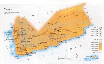 | YEMEN[Yamaniyyah] : |
| General useful information |
| Note: some data are of constant value, while other are due to changes, fluctuations etc. |
| Nation and population |
| official name (short form): Al-Yaman |
| country code ISO: YE //; - FIPS: YM |
| location: Southwest Asia |
| time zone: +3 UT |
| surface (land) area: 527970 sq.km = 203849 sq.mi //; - area incl. inland waters: sq.km = sq.mi |
| geographical position in extreme co-ordinates: North: 19° N / South: 13° N / East: 53° E / West: 43° E |
| borders (land): Saudi Arabia, Oman |
| borders (coastline): Gulf of Aden, Red Sea (both parts of Indian Ocean) |
| climate: arid and hot, temperature influenced by altitude |
| Government |
| independent since: 1918-12 ; 1990 |
| type of government: republic |
| capital: San'â' |
| administrative division: muhafazah [governorate] (17) + city (1) |
| Population |
| population according to the latest census (1994): 14587,807 |
| total population according to the estimate of midyear 2000: 17479,206; or: 17507,000 /-; 2001: 18078,035; or:18710,000 |
| population density: 33 per sq.km = 86 per sq.mi |
| population growth: 3,3% //; - doubling time: 21 years |
| birth rate: 43 - 45 per 1000 |
| death rate: 9 - 12 per 1000 |
| fertility rate: 7 children per female |
| maternal mortality: per 100,000 |
| infant mortality (1-4 years): 81 per 1000 |
| life expectancy: 57,5 - 60 years (male: 56 - 58; female: 59 - 62) |
| age breakdown: 0-14 years: 50% //; - 15-59 years: 46% //; - 60+ years: 4% |
| urbanisation: 25% //; - urbanisation growth: 5% |
| percentage of urban population in the greatest city: % |
| Ethnic composition, language, religion |
| ethnic groups: Arab 92%; Afro-Arab 3%; Indian 3%; Somali 1%; European 1% |
| languages: Arabic |
| religious affiliation: Muslim 99,9% (of which Sha'fi-Sunnî 53%; Zaydi-Shî'î 47%) |
| Health |
| daily food intake: 2087calories per capita |
| population with access to safe water: 39 - 69% |
| people per physician: 4211 |
| people per hospital bed: 1788 |
| Education, literacy |
| school enrolment: primary education 6-11 years: 76% |
| school enrolment: secondary education: 30% |
| school enrolment: tertiary education 20-24 years: 2% |
| adult literacy: 43% (male: 69%; female: 23%) [later total figure found: 46%] |
| Economy and infrastructure |
| Economy and trade |
| currency: Yemeni Rial = 100 fils |
| annual inflation rate: 22% |
| population below poverty line: 19 - 42% |
| Gross Domestic Product: USD 280 - 810 per capita |
| GNI USD 370 per capita //; - [ppp: 770] |
| GDP growth: 2% |
| income: USD 540 per capita |
| import: USD 2087 per capita //; - export: USD 934 per capita |
| trade: USD 141 per capita //; - or 83% of GDP |
| trade partners: RU GB ET SA US DE JP IT NL FR AU |
| human development index: 0,468 //; - position of the country in the world no.: 133 |
| female labour force: 28% |
| unemployment: 25% |
| tourism: 0,075 million |
| Economic activities in agriculture, fisheries, industry, mining, services, energy |
| land use: arable land: 3% //; - grass land: 30% //; - wooded area: 8% //; - arid land and desert: ca 55% |
| agriculture: labour force: 63% //; - part of agriculture in GDP: 22% |
| agricultural products: sorghum, potatoes, tomatoes, wheat, grapes, watermelons, bananas, onions, qat, coffee, cotton |
| livestock (million): asses: 0,5 / camels: 0,2 / cattle: 1,3 / goats: 4,3 / horses: 0,003 / poultry: 29 / sheep: 4,8 |
| fish catch: 115654 - 123252 metric tonnes |
| industry: labour force: 11% //; - part of industry in GDP: 26% |
| industry: labour force: 11% / - of GDP: 26% // CO2 emissions p.cap.: 0,9 // unemployment: 25% |
| industrial products: food processing, chemicals, oil |
| CO2 emission per capita: 0,9 |
| services: labour force: 26% //; - part of services in GDP: 52% |
| energy use (kg per capita): 184 |
| electricity use (per capita): 110 |
| annual water use (per capita): 136 |
| Traffic, communication |
| road network: 7264, or 64725 km //; - of which paved: 8 - 11,5% //; - of which are motorways: 0 km |
| vehicles: 13 per 1000 |
| railways: 0 km //; - railways passenger/km: - |
| navigable inland waterways: 0 km |
| ownership telephone: 12 per 1000 |
| ownership radio receivers: 43 - 48 per 1000 |
| ownership tv-sets: 6 - 243 per 1000 |
| newspaper circulation: 17 per 1000 |
| persons per post office: 34000 |
| personal computers: 2 per 1000 |
| Some physical landmarks |
| mountains: Jabal an Nabî Shu'ayb 3760 m, J. Nuqum 3400, J. Masar 3310, ? 3267, J. al-Hashâ 3227 |
| lowest point: sea level |
| lakes (natural): none, or unknown |
| lakes (artificial reservoirs): none, or unknown |
| lakes (deepest): unknown |
| rivers: mainly dry rivers (wâdîs), like: al Masîlah, Mawr, Zabîd, al Jîz, Aywat as Say'ar |
| canals: none, or unknown |
| waterfalls: none, or unknown |
| caves: longest system: none, or unknown / deepest: |
| islands: Suqutrá (Socotra) a.o. |
| deserts: southern part of the Arabian desert Rub' al-Khâli |
| other natural features: |
| Additional remarks, especially on the statistical information |
| other important features: |
| apart from physical landmarks most of the above figures are changeable, in most cases they date from the 1990's |
| some figures are not very recent, they are from the period before the unification of North and South |
| primary sources used for the general information: |
| BB CA EV PW WA WB WR, and some national statistical yearbooks |
| particulars concerning population data: |
 To the page containing the population growth statistics of the country
 To the page containing the historical population growth statistics of the provinces
 To the page containing urban historical population statistics
 Back to the homepage of this website: POPULATION STATISTICS
Internet website: Internet website:Latest modification of this page on 2004-03-15 by Jan Lahmeyer
© "populstat" site: Jan Lahmeyer