All countries of the world listed from A-Z:

or choose from the countries per continent below:


 |  |  |  |  |  |
 | THAILAND[Prathet Thai ; Prades Thai ; Muang Thai ; Siam] : |
| General useful information |
| Note: some data are of constant value, while other are due to changes, fluctuations etc. |
| Nation and population |
| official name (short form): Muang T'hai ; Prathet T'hai |
| country code ISO: TH //; - FIPS: TH |
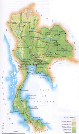
| location: Southeast Asia |
| time zone: +7 UT |
| surface (land) area: 513115 sq.km = 198115 sq.mi //; - area incl. inland waters: sq.km = sq.mi |
| geographical position in extreme co-ordinates: North: 20° N / South: 5° N / East: 105° E / West: 97° E |
| borders (land): Myanmar, Laos, Cambodia, Malaysia |
| borders (coastline): Andaman Sea, Gulf of Thailand (both parts of Indian Ocean) |
| climate: tropical monsoon |
| Government |
| independent since: 1350 ; 1882 |
| type of government: constitutional monarchy |
| capital: Krung Thep (Bangkok) |
| administrative division: region (6) + metropolis (1) into changwat [=province] (76) |
| Population |
| population according to the last two censuses: (1990): 54532,300 /-; (2000): 60606,947 |
| total population according to the estimate of midyear 2000: 61230,874; or: 60728,000 /-; 2001: 61213,000; or: 61797,751 |
| population density: 118 per sq.km = 306 per sq.mi |
| population growth: 1,5% //; - doubling time: 63 years |
| birth rate: 17 - 18 per 1000 |
| death rate: 7 - 8 per 1000 |
| fertility rate: 2 children per female |
| maternal mortality: 270 per 100,000 |
| infant mortality (1-4 years): 32 per 1000 |
| life expectancy: 69 years (male: 66; female: 72) |
| age breakdown: 0-14 years: 27% //; - 15-59 years: 65% //; - 60+ years: 8% |
| urbanisation: 22% //; - urbanisation growth: 3% |
| percentage of urban population in the greatest city: 69% |
| Ethnic composition, language, religion |
| ethnic groups: Thai 80% (Siamese 53%, Lao 27%); Chinese 12%; Malay 4%; Khmer 3% |
| languages: Thai (official); Chinese, Malay, English |
| religious affiliation: Buddhist 95%; Muslim 4%; Christian 0,6% |
| Health |
| daily food intake: 2462 calories per capita |
| population with access to safe water: 89% |
| people per physician: 3461 |
| people per hospital bed: 466 |
| Education, literacy |
| school enrolment: primary education 6-11 years: 87% |
| school enrolment: secondary education: 28% |
| school enrolment: tertiary education 20-24 years: 16% |
| adult literacy: 89% (male: 93%; female: 85%) [later as total figures found: 94 - 96%] |
| Economy and infrastructure |
| Economy and trade |
| currency: Thai baht = 100 satangs |
| annual inflation rate: 4% |
| population below poverty line: 13% |
| Gross Domestic Product: USD 2210 per capita |
| GNI USD 2000 per capita //; - [ppp: 6320] |
| GDP growth: 3% |
| income: USD 1580 per capita |
| import: USD 71837 per capita //; - export: USD 56743 per capita |
| trade: USD 1152 per capita //; - or 107% of GDP |
| trade partners: JP US SG DE |
| human development index: 0,757 //; - position of the country in the world no.: 66 |
| female labour force: 46% |
| unemployment: 2,4% |
| tourism: 9 million |
| Economic activities in agriculture, fisheries, industry, mining, services, energy |
| land use: arable land: 43% //; - grass land: 2% //; - wooded area: 28% //; - arid land and desert: % |
| agriculture: labour force: 70% //; - part of agriculture in GDP: 12% |
| agricultural products: rice, sugarcane, tapioca, maize, palm oil, rubber, soybean, coffee, kenaf, cassava |
| livestock (million): buffalo 1,9 / cattle: 6,1 / goats: 0,1 / pigs: 6,5 / poultry: 232 / sheep: 0,04 |
| fish catch: 3005000 - 3500000 metric tonnes |
| industry: labour force: 6% //; - part of industry in GDP: 39% |
| industrial products: cement, refined sugar, chemical fertilizer, synthetic fibre, iron sheet, tin plate, textiles, agricultural processing |
| mining products: tin, lignite, gas, gems, oil, tungsten, lead, zinc, antimony, potash, limestone, gypsum, kaolin, fluorite |
| CO2 emission per capita: 3,2 |
| services: labour force: 24% //; - part of services in GDP: 49% |
| energy use (kg per capita): 1169 |
| electricity use (per capita): 1352 |
| annual water use (per capita): 602 |
| Traffic, communication |
| road network: 64600, or 73233 km //; - of which paved: 98% //; - of which are motorways: 0 km |
| vehicles: 18 per 1000 |
| railways: 3755, or 4623 km //; - railways passenger/km: 12975 |
| navigable inland waterways: 3701 km |
| ownership telephone: 59 - 86 per 1000 |
| ownership radio receivers: 167 - 232 per 1000 |
| ownership tv-sets: 54 - 289 per 1000 |
| newspaper circulation: 47 per 1000 |
| persons per post office: 13900 |
| personal computers: 24 per 1000 |
| Some physical landmarks |
| mountains: Doi Inthanon 2594 m, Doi Pha Hom Pok 2297, Chiang Dao 2185 |
| lowest point: sea level |
| lakes (natural): none, or unknown |
| lakes (artificial reservoirs): some reservoirs |
| lakes (deepest): unknown |
| rivers: Mae Nam Chao Phraya, Mae Nam Ping, Mae Nam Mun, Mae Nam Chi, Mae Nam Mae Klong |
| canals: none, or unknown |
| waterfalls: none, or unknown |
| caves: longest system: none, or unknown / deepest: |
| islands: Ko Phuket, Ko Samui, Ko Phangan, Ko Chang, Ko Terutao, Ko Lanta |
| deserts: none |
| other natural features: |
| Additional remarks, especially on the statistical information |
| other important features: |
| apart from physical landmarks most of the above figures are changeable, in most cases they date from the 1990's |
| primary sources used for the general information: |
| BB CA EV PW WA WB WR, and some national statistical yearbooks |
| particulars concerning population data: |
 To the page containing the population growth statistics of the country
 To the page containing the historical population growth statistics of the provinces
 To the page containing urban historical population statistics
 Back to the homepage of this website: POPULATION STATISTICS
Internet website:Latest modification of this page on 2004-03-09 by Jan Lahmeyer
© "populstat" site: Jan Lahmeyer