All countries of the world listed from A-Z:

or choose from the countries per continent below:


 |  |  |  |  |  |
 | PALESTINA[West Bank and Gaza Strip] : |
| General useful information |
| Note: some data are of constant value, while other are due to changes, fluctuations etc. |
| Nation and population |
| official name (short form): Palestina |
| country code ISO: PS //; - FIPS: - |
| location: Southwest Asia, Middle East |
| time zone: +2 UT* [*= applying daylight saving time] |
| surface (land) area: 5997 sq.km = 2315.5 sq.mi //; - area incl. inland waters: sq.km = sq.mi |
| geographical position in extreme co-ordinates: North: / South: / East: / West: [at this moment unknown] |
| borders (land): Egypt, Israel, Lebanon 75 km, Syria 74, Jordan 360, Sinai and Gulf of Aqaba 240 |
| borders (coastline): Mediterranean Sea 224 km |
| climate: continental subtropic (West Bank) Mediterranean (Gaza) |
| Government |
| independent since: projected for 2005 |
| type of government: republic |
| capital: Al-Quds (East-Jerusalem) |
| administrative division: governorate (16) |
| Population |
| population according to the latest census (1993): 1767,500 |
| total population according to the estimate of midyear 2000: 3152,361; or: 2966,000 /-; 2001: 3269,000 |
| population density: 500 per sq.km = 1296 per sq.mi |
| population growth: 4% //; - doubling time: ca 20 years |
| birth rate: 30 per 1000 |
| death rate: 4 per 1000 |
| fertility rate: children per female |
| maternal mortality: per 100,000 |
| infant mortality (1-4 years): 22 per 1000 |
| life expectancy: 72 years (male: ; female: ) |
| age breakdown: 0-14 years: 49% //; - 15-59 years: 40% //; - 60+ years: 11% |
| urbanisation: % //; - urbanisation growth: % |
| percentage of urban population in the greatest city: % |
| Ethnic composition, language, religion |
| ethnic groups: Palestinian |
| languages: Arab |
| religious affiliation: Muslim |
| Health |
| daily food intake: calories per capita |
| population with access to safe water: % |
| people per physician: |
| people per hospital bed: |
| Education, literacy |
| school enrolment: primary education 6-11 years: % |
| school enrolment: secondary education: % |
| school enrolment: tertiary education 20-24 years: % |
| adult literacy: % (male: %; female: %) |
| Economy and infrastructure |
| Economy and trade |
| currency: no domestic currency yet in use; Israeli shekel, Jordanian dinar and US dollar circulate |
| annual inflation rate: % |
| population below poverty line: % |
| Gross Domestic Product: USD 4173 per capita |
| GNI USD 1660 per capita //; - [ppp: ] |
| GDP growth: -1,5% |
| income: USD per capita |
| import: USD 450 per capita //; - export: USD 70 per capita |
| trade: USD per capita //; - or % of GDP |
| trade partners: unknown |
| human development index: //; - position of the country in the world no.: |
| female labour force: <10% |
| unemployment: % |
| tourism: 0,3 million |
| Economic activities in agriculture, fisheries, industry, mining, services, energy |
| land use: arable land: % //; - grass land: % //; - wooded area: % //; - arid land and desert: % |
| agriculture: labour force: 11% //; - part of agriculture in GDP: % |
| agricultural products: vegetables, [citrus] fruits, fishing |
| livestock (1000s): cattle: 15 / goats: 30 / poultry: 3700 / sheep: 24 |
| fish catch: metric tonnes |
| industry: labour force: 40% //; - part of industry in GDP: % |
| industrial products: unknown |
| mining products: salt |
| CO2 emission per capita: |
| services: labour force: 49% //; - part of services in GDP: % |
| energy use (kg per capita): |
| electricity use (per capita): |
| annual water use (per capita): |
| Traffic, communication |
| road network: km //; - of which paved: % //; - of which are motorways: km |
| vehicles: 43 per 1000 |
| railways: 0 km //; - railways passenger/km: - |
| navigable inland waterways: 0 km |
| ownership telephone: 33 per 1000 |
| ownership radio receivers: per 1000 |
| ownership tv-sets: per 1000 |
| newspaper circulation: per 1000 |
| persons per post office: |
| personal computers: per 1000 |
| Some physical landmarks |
| mountains: Mt. Kharbet 1220, Mt. Al-Jarmak 1208, Mt. Haudar 1047, Mt. Ras Al-Ruman 1035, Ramat el Halil (?) 1020, Mt. Halhul 1018, Tell Asûr 1016 |
| lowest point: 396 m below sea level, border of the Dead Sea |
| lakes (natural): Al-Bahr al-Mayyit (Dead Sea) 1050 sq.km, Tiberias 165, Hula 14 |
| lakes (artificial reservoirs): none, or unknown |
| lakes (deepest): Dead Sea (?) |
| rivers: Nahr al-Urdunn (Jordan) 194 km, Al-Hasbani 39, Al-Awja 26, Al-Yarmouk 17, Al-Makta 13, Al-Na'amin 8 |
| canals: none, or unknown |
| waterfalls: none, or unknown |
| caves: longest system: none, or unknown / deepest: |
| islands: none |
| deserts: no real vast desert area |
| other natural features: |
| Additional remarks, especially on the statistical information |
| other important features: |
| apart from physical landmarks most of the above figures are changeable, in most cases they date from the 1990's |
| not all specific data for Palestine are known; they are not clearly distinguished in the sources used |
| primary sources used for the general information: |
| BB CA EV PW WA WB WR, and some national statistical yearbooks |
| particulars concerning population data: |
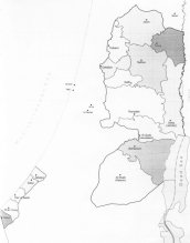
There is no detailed information available of the whole country
 To the page containing the historical population growth statistics of the provinces
 To the page containing urban historical population statistics
 Back to the homepage of this website: POPULATION STATISTICS
Latest modification of this page on 2004-03-01 by Jan Lahmeyer
© "populstat" site: Jan Lahmeyer