All countries of the world listed from A-Z:

or choose from the countries per continent below:


 |  |  |  |  |  |
 | IRAQgeneral data of the country |
| General useful information |
| Note: some data are of constant value, while other are due to changes, fluctuations etc. |
| Nation and population |
| official name (short form): 'Irâq |
| country code ISO: IQ //; - FIPS: IZ |
| location: Southwest Asia, Middle East |
| time zone: +3 UT |
| surface (land) area: 435052 sq.km = 167975 sq.mi //; - area incl. inland waters: sq.km = sq.mi |
| geographical position in extreme co-ordinates: North: 37° N / South: 29° N / East: 49° E / West: 39° E |
| borders (land): Kuwait, Saudi Arabia, Jordan, Syria, Turkey, Iran |
| borders (coastline): Persian Gulf (part of Indian Ocean) |
| climate: (sub)tropical, semi arid to arid |
| Government |
| independent since: 1932-10-03 |
| type of government: republic |
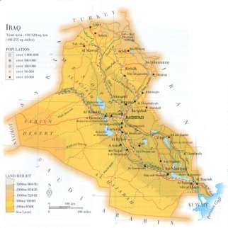
| capital: Baghdâd |
| administrative division: liwa / governorate (18) |
| Population |
| population according to the latest census (1997): 22017,983 |
| total population according to the estimate of midyear 2000: 22675,617; or: 23264,000; 2001: 23584,000 |
| population density: 54 per sq.km = 139 per sq.mi |
| population growth: 3,5% //; - doubling time: 29 years |
| birth rate: 35 - 44 per 1000 |
| death rate: 6 - 7per 1000 |
| fertility rate: 7 children per female |
| maternal mortality: 50 per 100,000 |
| infant mortality (1-4 years): 67 per 1000 |
| life expectancy: 61 - 67 years (male: 66; female: 68) |
| age breakdown: 0-14 years: 46% //; - 15-59 years: 49% //; - 60+ years: 4% |
| urbanisation: 77% //; - urbanisation growth: 5% |
| percentage of urban population in the greatest city: 55% |
| Ethnic composition, language, religion |
| ethnic groups: Arab 77%; Kurd 19%; Azerbaijani / Turkoman 2%; Persian 2%; Assyrian 0,8% |
| languages: Arabic (official); Kurdish, Turkish |
| religious affiliation: Shî'î Muslim 54 - 65%; Sunnî Muslim 32 - 42% (difference depends on source) |
| Health |
| daily food intake: 2419 calories per capita |
| population with access to safe water: 44% |
| people per physician: 1818 |
| people per hospital bed: 704 |
| Education, literacy |
| school enrolment: primary education 6-11 years: 96% |
| school enrolment: secondary education: 47% |
| school enrolment: tertiary education 20-24 years: 14% |
| adult literacy: 60% (male: %; female: %) |
| Economy and infrastructure |
| Economy and trade |
| currency: Dinar = 20 dirhams = 1000 fils |
| annual inflation rate: unknown, supposed to be high [45%?] |
| population below poverty line: % |
| Gross Domestic Product: USD 1036 per capita |
| GNI USD 2700 per capita //; - [ppp: ] |
| GDP growth: 10% [a not so actual figure] |
| income: USD 2000 per capita |
| import: USD 4834 per capita //; - export: USD 6659 per capita |
| trade: USD 276 per capita //; - or % of GDP |
| trade partners: TR UA JR DE JP |
| human development index: 0,567 //; - position of the country in the world no.: ca 115 |
| female labour force: 20% |
| unemployment: % |
| tourism: 0,078 million |
| Economic activities in agriculture, fisheries, industry, mining, services, energy |
| land use: arable land: 12% //; - grass land: 9% //; - wooded area: 4% //; - arid land and desert: ca 70% |
| agriculture: labour force: 13% //; - part of agriculture in GDP: 25% |
| agricultural products: dates, cattle, sheep, cereals, goats, camels, cotton |
| livestock (1000s): asses: 380 / buffalo: 65 / camels: 8 / cattle: 1350 / goats: 1600 / poultry: 23000 / sheep: 6780 |
| fish catch: 24606 - 34702 metric tonnes |
| industry: labour force: 8% //; - part of industry in GDP: 41% |
| industrial products: oil and gas production, food processing, textiles, chemicals, cement |
| mining products: natural oil & gas, sulphur |
| CO2 emission per capita: 3,7 |
| services: labour force: 80% //; - part of services in GDP: 42% |
| energy use (kg per capita): 1263 |
| electricity use (per capita): 1303 |
| annual water use (per capita): 4575 |
| Traffic, communication |
| road network: 25479 - 47400 km //; - of which paved: 85% //; - of which are motorways: 0 km |
| vehicles: 34 per 1000 |
| railways: 2032 km //; - railways passenger/km: 1566 |
| navigable inland waterways: 130 - 1015 km |
| ownership telephone: 33 per 1000 |
| ownership radio receivers: 167 - 630 per 1000 |
| ownership tv-sets: 48 - 83 per 1000 |
| newspaper circulation: 27 per 1000 |
| persons per post office: |
| personal computers: per 1000 |
| Some physical landmarks |
| mountains: Kúh-e Hájí Ebráhím 3600 - 3658 m |
| lowest point: sea level |
| lakes (natural): Buhayrat ath Tharthár, Buhayrat ar Razázah, Hawr al Hammár, Hawr as Sa'díyah |
| lakes (artificial reservoirs): some small ones |
| lakes (deepest): unknown |
| rivers: Al Furat (Euphrates), Dijla / Digla (Tigris), Záb al Kábir (Great Zab) |
| canals: Shatt al Arab |
| waterfalls: unknown |
| caves: longest system: unknown / deepest: |
| islands: none, or unknown |
| deserts: Al Jazírah (nw), Al Harajah (s), Syrian desert (w) |
| other natural features: |
| Additional remarks, especially on the statistical information |
| other important features: |
| apart from physical landmarks most of the above figures are changeable, in most cases they date from the 1990's |
| primary sources used for the general information: |
| BB CA EV PW WA WB WR, and some national statistical yearbooks |
| particulars concerning population data: |
 To the page containing the population growth statistics of the country
 To the page containing the historical population growth statistics of the provinces
 To the page containing urban historical population statistics
 Back to the homepage of this website: POPULATION STATISTICS
Internet website: Internet website:Latest modification of this page on 2004-02-18 by Jan Lahmeyer
© "populstat" site: Jan Lahmeyer