All countries of the world listed from A-Z:

or choose from the countries per continent below:


 |  |  |  |  |  |
 | NICARAGUAgeneral data of the country |
| General useful information |
| Note: some data are of constant value, while other are due to changes, fluctuations etc. |
| Nation and population |
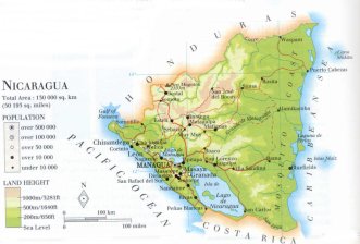
| official name (short form): Nicaragua |
| country code ISO: NI //; - FIPS: NU |
| location: Central America |
| time zone: -6 UT |
| surface (land) area: 130000 sq.km = 50193 sq.mi //; - area incl. inland waters: sq.km = sq.mi |
| geographical position in extreme co-ordinates: North: 15° N / South: 11° N / East: 83° W / West: 88° W |
| borders (land): Honduras, Costa Rica |
| borders (coastline): Caribbean Sea (Atlantic Ocean), Pacific Ocean |
| climate: tropical |
| Government |
| independent since: 1838-04-30 |
| type of government: republic |
| capital: Managua |
| administrative division: departamento (16) |
| Population |
| population according to the last two censuses: (1971): 1877,952; (1995): 4357,099 |
| total population according to the estimate of midyear 2000: 4812,569; or: 5071,000 /-; 2001: 5208,000 |
| population density: 37 per sq.km = 96 per sq.mi |
| population growth: 2,9% //; - doubling time: 25 years |
| birth rate: 28 - 35 per 1000 |
| death rate: 5 -6 per 1000 |
| fertility rate: 5 children per female |
| maternal mortality: 47 per 100,000 |
| infant mortality (1-4 years): 48 per 1000 |
| life expectancy: 69 years (male: 67; female: 71) |
| age breakdown: 0-14 years: 46% //; - 15-59 years: 50% //; - 60+ years: 4% |
| urbanisation: 56% //; - urbanisation growth: 5% |
| percentage of urban population in the greatest city: 47% |
| Ethnic composition, language, religion |
| ethnic groups: Mestizo 69%; white 17%; black 9%; Amerindian 5% |
| languages: Spanish (official); Indian, Creole, Chibcha |
| religious affiliation: Roman Catholic 73%; other (mostly Baptist, Moravian and Pentecostal) 17%; other: 10% |
| Health |
| daily food intake: 2208 calories per capita |
| population with access to safe water: 81% |
| people per physician: 1566 |
| people per hospital bed: |
| Education, literacy |
| school enrolment: primary education 6-11 years: 85% |
| school enrolment: secondary education: 27% |
| school enrolment: tertiary education 20-24 years: 1% |
| adult literacy: 66% (male: %; female: %) |
| Economy and infrastructure |
| Economy and trade |
| currency: Córdoba oro = 100 centavos |
| annual inflation rate: 33,5% |
| population below poverty line: 50% |
| Gross Domestic Product: USD 2000 per capita |
| GNI USD 400 per capita //; - [ppp: 2080] |
| GDP growth: 0,6% |
| income: USD 340 per capita |
| import: USD 1009 per capita //; - export: USD 509 per capita |
| trade: USD 349 per capita //; - or 101% of GDP |
| trade partners: CIS-countries CU FR ES JP DE US BE |
| human development index: 0,635 //; - position of the country in the world no.: 106 |
| female labour force: 36% |
| unemployment: 10% |
| tourism: 0,5 million |
| Economic activities in agriculture, fisheries, industry, mining, services, energy |
| land use: arable land: 11% //; - grass land: 45% //; - wooded area: 28% //; - arid land and desert: % |
| agriculture: labour force: 47% //; - part of agriculture in GDP: 30% |
| agricultural products: coffee, beef, maize, milk, rice, sugarcane, beans, sorghum, shrimp, lobster, bananas, citrus |
| livestock (1000s): asses: 9 / cattle: 2050 / goats: 6 / horses: 246 / mules: 46 / pigs: 420 / poultry: 14000 / sheep: 4 |
| fish catch: 16130 - 20569 metric tonnes |
| industry: labour force: 16% //; - part of industry in GDP: 23% |
| industrial products: food processing (meat, beverages, sugar, tobacco, fish), building materials, chemicals, textiles |
| mining products: gold, silver, lead, zinc, copper, tungsten |
| CO2 emission per capita: 0,7 |
| services: labour force: 38% //; - part of services in GDP: 47% |
| energy use (kg per capita): 539 |
| electricity use (per capita): 268 |
| annual water use (per capita): 370 |
| Traffic, communication |
| road network: 15287 km //; - of which paved: 11% //; - of which are motorways: 384 km [Pan American highway] |
| vehicles: 12 per 1000 |
| railways: 287, or 321 km //; - railways passenger/km: 66 |
| navigable inland waterways: 2220 km |
| ownership telephone: 23 - 30 per 1000 |
| ownership radio receivers: 222 - 285 per 1000 |
| ownership tv-sets: 48 - 190 per 1000 |
| newspaper circulation: 30 per 1000 |
| persons per post office: 21600 |
| personal computers: 9 per 1000 |
| Some physical landmarks |
| mountains: Pico Mogotón 2103 m, Kilambe 1750, Volcán San Cristóbal 1745 |
| lowest point: sea level |
| lakes (natural): Lago de Nicaragua, Lago de Managua |
| lakes (artificial reservoirs): none, or unknown |
| lakes (deepest): unknown |
| rivers: Coc(c)o, Río Grande de Matagalpa, San Juan |
| canals: none, or unknown |
| waterfalls: none, or unknown |
| caves: longest system: none, or unknown / deepest: |
| islands: Islas Maíz, Cayos Miskitos, Isla de Omotepe, Isla Zapatera |
| deserts: none |
| other natural features: |
| Additional remarks, especially on the statistical information |
| other important features: |
| apart from physical landmarks most of the above figures are changeable, in most cases they date from the 1990's |
| primary sources used for the general information: |
| BB CA EV PW WA WB WR, and some national statistical yearbooks |
| particulars concerning population data: |
 To the page containing the population growth statistics of the country
 To the page containing the historical population growth statistics of the provinces
 To the page containing urban historical population statistics
 Back to the homepage of this website: POPULATION STATISTICS
Internet website:Latest modification of this page on 2004-02-29 by Jan Lahmeyer
© "populstat" site: Jan Lahmeyer