All countries of the world listed from A-Z:

or choose from the countries per continent below:


 |  |  |  |  |  |
 | FRENCH GUIANA[Guyane française] : general data of the country |
| General useful information |
| Note: some data are of constant value, while other are due to changes, fluctuations etc. |
| Nation and population |
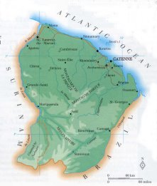
| official name (short form): Guyane française |
| country code ISO: GF //; - FIPS: FG |
| location: Northern South America |
| time zone: -3 UT |
| surface (land) area: 88150 sq.km = 34749 sq.mi //; - area incl. inland waters: sq.km = sq.mi |
| geographical position in extreme co-ordinates: North: 6° N / South: 2° N / East: 52° W / West: 55° W |
| borders (land): Suriname, Brazil |
| borders (coastline): Atlantic Ocean |
| climate: tropical humid |
| Government |
| independent since: not yet |
| type of government: overseas department of France since 1947-01 |
| capital: Cayenne |
| administrative division: district (2); into canton (14), or commune (22) |
| Population |
| population according to the latest census (1999): 157,213 |
| total population according to the estimate of midyear 2000: 172,605 // - ; 2001: 177,562 |
| population density: per 1,8 sq.km = 4,7 per sq.mi |
| population growth: 5,5% //; - doubling time: years |
| birth rate: 28 - 31 per 1000 |
| death rate: 4 -6 per 1000 |
| fertility rate: 2 children per female |
| maternal mortality: per 100,000 |
| infant mortality (1-4 years): 18 per 1000 |
| life expectancy: 72 years (male: 69; female: 76) |
| age breakdown: 0-14 years: % //; - 15-59 years: % //; - 60+ years: % |
| urbanisation: 75% //; - urbanisation growth: % |
| percentage of urban population in the greatest city: 40% |
| Ethnic composition, language, religion |
| ethnic groups: Creole 42%; Chinese 14%; French 10%; Haitian 7% |
| languages: French, Creole patois |
| religious affiliation: Roman Catholic 75 - 80%; Protestant 4% |
| Health |
| daily food intake: calories per capita |
| population with access to safe water: % |
| people per physician: |
| people per hospital bed: |
| Education, literacy |
| school enrolment: primary education 6-11 years: % |
| school enrolment: secondary education: % |
| school enrolment: tertiary education 20-24 years: % |
| adult literacy: 83% (male: 84%; female: 82%) |
| Economy and infrastructure |
| Economy and trade |
| currency: Euro = 100 cents (until 2002: French franc = 100 centimes) |
| annual inflation rate: 1,5% |
| population below poverty line: % |
| Gross Domestic Product: USD 6000 per capita |
| GNI USD per capita //; - [ppp: ] |
| GDP growth: % |
| income: USD 4000 per capita |
| import: USD 783 per capita //; - export: USD 158 per capita |
| trade: USD 8390 per capita //; - or % of GDP |
| trade partners: FR TT US |
| human development index: //; - position of the country in the world no.: |
| female labour force: 38% |
| unemployment: % |
| tourism: 0,07 million |
| Economic activities in agriculture, fisheries, industry, mining, services, energy |
| land use: arable land: 0,1% //; - grass land: 15% //; - wooded area: 83% //; - arid land and desert: % |
| agriculture: labour force: 11% //; - part of agriculture in GDP: 35% |
| agricultural products: timber, shrimps, rum, essences, sugarcane, cassava, rice, roots & tubers, bananas |
| livestock (1000s): asses: / cattle: 9 / goats: 1 / horses: / pigs: 11 / poultry: 190 / sheep: 3 |
| fish catch: 7700 metric tonnes |
| industry: labour force: 6% //; - part of industry in GDP: % |
| industrial products: rum |
| mining products: gold, gravel stone; bauxite and kaolin have been discovered but largely unexploited |
| CO2 emission per capita: |
| services: labour force: 83% //; - part of services in GDP: % |
| energy use (kg per capita): 1473 |
| electricity use (per capita): |
| annual water use (per capita): |
| Traffic, communication |
| road network: 722 - 1137 km //; - of which paved: 40% //; - of which are motorways: 0 km |
| vehicles: 185 per 1000 |
| railways: 30 km (only for mining material) //; - railways passenger/km: - |
| navigable inland waterways: 460 km |
| ownership telephone: 277 - 288 per 1000 |
| ownership radio receivers: 486 - 650 per 1000 |
| ownership tv-sets: 170 - 188 per 1000 |
| newspaper circulation: 11 per 1000 |
| persons per post office: |
| personal computers: per 1000 |
| Some physical landmarks |
| mountains: Mt. Bellevue de'Inini 850 m, Massif Tabulaire 830, unnamed peak 792, Mt. Cottica 710 |
| lowest point: sea level |
| lakes (natural): unknown |
| lakes (artificial reservoirs): a relatively reservoir in the Sinnemary river, until now without a name on the map |
| lakes (deepest): |
| rivers: Maroni, Mana, Sinnemary, Kourou, Comté, Approuague, Oyapock |
| canals: none |
| waterfalls: unknown |
| caves: longest system: unknown / deepest: |
| islands: Îles du Diable, Îles du Salut, Île de Cayenne, La Mère |
| deserts: none |
| other natural features: |
| Additional remarks, especially on the statistical information |
| other important features: |
| apart from physical landmarks most of the above figures are changeable, in most cases they date from the 1990's |
| primary sources used for the general information: |
| BB CA EV PW WA WB WR, and some national statistical yearbooks |
| particulars concerning population data: |
| the data prior to 1950 are subjected to over-enumeration |
 To the page containing the population growth statistics of the country
 To the page containing the historical population growth statistics of the provinces
 To the page containing urban historical population statistics
 Back to the homepage of this website: POPULATION STATISTICS
Internet website: For more figures of FranceLatest modification of this page on 2004-02-11 by Jan Lahmeyer
© "populstat" site: Jan Lahmeyer