All countries of the world listed from A-Z:

or choose from the countries per continent below:


 |  |  |  |  |  |
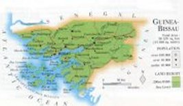 | GUINEA -BISSAUgeneral data of the country |
| General useful information |
| Note: some data are of constant value, while other are due to changes, fluctuations etc. |
| Nation and population |
| official name (short form): Guiné-Bissau |
| country code ISO: GW //; - FIPS: PU |
| location: West Africa |
| time zone: +0 UT |
| surface (land) area: 36120 sq.km = 13946 sq.mi //; - area incl. inland waters: sq.km = sq.mi |
| geographical position in extreme co-ordinates: North: 13° N / South: 11° N / East: 13° W / West: 17° W |
| borders (land): Senegal, Guinea |
| borders (coastline): Atlantic Ocean |
| climate: tropical |
| Government |
| independent since: 1974-09-10 |
| type of government: republic |
| capital: Bissau |
| administrative division: region (8) |
| Population |
| population according to the latest census (1991): 983,367 |
| total population according to the estimate of midyear 2000: 1199, 000; or: 1285,715 // - ; 2001: 1227,000; or: 1315,822 |
| population density: 33 per sq.km = 86 per sq.mi |
| population growth: 2,5% //; - doubling time: 33 years |
| birth rate: 39 - 43 per 1000 |
| death rate: 15 - 21 per 1000 |
| fertility rate: 6 children per female |
| maternal mortality: per 100,000 |
| infant mortality (1-4 years): 140 per 1000 |
| life expectancy: 45 - 49 years (male: 42 - 47; female: 45 - 52) |
| age breakdown: 0-14 years: 41% //; - 15-59 years: 53% //; - 60+ years: 7% |
| urbanisation: 23% //; - urbanisation growth: % |
| percentage of urban population in the greatest city: % |
| Ethnic composition, language, religion |
| ethnic groups: Balante 30%; Malinké [Fula] 20%; Mandyako [Manjaka] 14%; Mandinga 13%; Pepel 7% |
| languages: Portuguese (official); Crioulo; tribal Sudanese languages |
| religious affiliation: Muslim 30 - 90%; traditional beliefs 1 - 65%; Christian 5 - 15% |
| Health |
| daily food intake: 2411 calories per capita |
| population with access to safe water: 53% |
| people per physician: 7500 |
| people per hospital bed: |
| Education, literacy |
| school enrolment: primary education 6-11 years: 38% |
| school enrolment: secondary education: % |
| school enrolment: tertiary education 20-24 years: % |
| adult literacy: 36% (male: %; female: %) [later as total figure found: 55%] |
| Economy and infrastructure |
| Economy and trade |
| currency: CFA franc = 100 centimes |
| annual inflation rate: 33% |
| population below poverty line: 49% |
| Gross Domestic Product: USD 250 per capita |
| GNI USD 180 per capita //; - [ppp: 710] |
| GDP growth: -1% |
| income: USD 190 per capita |
| import: USD 64 per capita //; - export: USD 33 per capita |
| trade: USD 85 per capita //; - or 84% of GDP |
| trade partners: PT ES FR CH CV SG NL IN CIS |
| human development index: 0,339 //; - position of the country in the world no.: 156 |
| female labour force: 41% |
| unemployment: % |
| tourism: million |
| Economic activities in agriculture, fisheries, industry, mining, services, energy |
| land use: arable land: 12% //; - grass land: 38% //; - wooded area: 38% //; - arid land and desert: % |
| agriculture: labour force: 82% //; - part of agriculture in GDP: 46% |
| agricultural products: cashew nuts, groundnuts, rice, sugar cane, tropical fruits, cotton, tobacco, corn, beans |
| livestock (1000s): cattle: 512 / goats: 325 / pigs: 345 / poultry: 850 / sheep: 285 |
| fish catch: 5000 metric tonnes |
| industry: labour force: 4% //; - part of industry in GDP: 12% |
| industrial products: fishing industry |
| mining products: bauxite, phosphate, natural oil |
| CO2 emission per capita: 0,8 |
| services: labour force: 14% //; - part of services in GDP: 42% |
| energy use (kg per capita): 37 - 46 |
| electricity use (per capita): |
| annual water use (per capita): 11 |
| Traffic, communication |
| road network: 4400 km //; - of which paved: 10% //; - of which are motorways: 0 km |
| vehicles: 4 per 1000 |
| railways: 0 km //; - railways passenger/km: - |
| navigable inland waterways: unknown km; most rivers are extensively navigable |
| ownership telephone: 7 - 10 per 1000 |
| ownership radio receivers: 36 -43 per 1000 |
| ownership tv-sets: unknown, or zero per 1000 |
| newspaper circulation: 6 per 1000 |
| persons per post office: 43300 |
| personal computers: per 1000 |
| Some physical landmarks |
| mountains: Madina do Boé 262 m; other elevations are of no importance, it's a relatively flat country |
| lowest point: sea level |
| lakes (natural): none, or unknown |
| lakes (artificial reservoirs): none, or unknown |
| lakes (deepest): unknown |
| rivers: Río Gêba, Río Cacheu, Río Corubal |
| canals: none, or unknown |
| waterfalls: none, or unknown |
| caves: longest system: none, or unknown / deepest: |
| islands: Archipelago do Bijagós: Ilha de Orango, Caravela, Bubaque, Roxa, Bolama, Uno, Formosa |
| deserts: none |
| other natural features: |
| Additional remarks, especially on the statistical information |
| other important features: |
| apart from physical landmarks most of the above figures are changeable, in most cases they date from the 1990's |
| if there is a range between the figures, the differences are due to the use of several sources |
| primary sources used for the general information: |
| BB CA EV PW WA WB WR, and some national statistical yearbooks |
| particulars concerning population data: |
 To the page containing the population growth statistics of the country
 To the page containing the historical population growth statistics of the provinces
 To the page containing urban historical population statistics
 Back to the homepage of this website: POPULATION STATISTICS
Internet website:Latest modification of this page on 2004-02-15 by Jan Lahmeyer
© "populstat" site: Jan Lahmeyer