All countries of the world listed from A-Z:

or choose from the countries per continent below:


 |  |  |  |  |  |
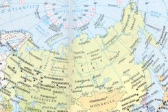 | RUSSIA[Rossija] : |
| General useful information |
| Note: some data are of constant value, while other are due to changes, fluctuations etc. |
| Nation and population |
| official name (short form): Rossija ; Rossijskaja Federa`'cija |
| country code ISO: RU //; - FIPS: RS |
| location: East Europe, North Asia |
| time zones: from +3 to +12 UT* [*= applying daylight saving time] |
| surface (land) area: 173750400 sq.km = 6592800 sq.mi //; - area incl. inland waters: sq.km = sq.mi |
| geographical position in extreme co-ordinates: North: 81°N / South: 42° N / East: 169° W / West: 19° E |
| borders (land): too many countries in East Europe and Central and East Asia to mention here |
| borders (coastline): Arctic Sea, Baltic Sea, Black Sea, North Atlantic Ocean, North Pacific Ocean |
| climate: various, mostly cold continental |
| Government |
| independent since: 9th cent.; 1991-12-08 |
| type of government: republic |
| capital: Moskva (Moscow) |
| administrative division: oblast, kraj, okrug: for more details see the separate file |
| Population |
| population according to the latest census (1989): 147021,869, or: 147400,537 |
| total population according to the estimate of midyear 2000: 146001,200; or: 145555,000 /-; 2001: 144664,000 |
| population density: 8 per sq.km = 22 per sq.mi |
| population growth: -0,02% //; - doubling time: not applicable, declining population |
| birth rate: 9 per 1000 |
| death rate: 14 - 15 per 1000 |
| fertility rate: 1 child per female |
| maternal mortality: per 100,000 |
| infant mortality (1-4 years): 17 per 1000 |
| life expectancy: 67 years (male: 62; female: 73) |
| age breakdown: 0-14 years: 23% //; - 15-59 years: 61,5% //; - 60+ years: 15,5% |
| urbanisation: 73 - 77% //; - urbanisation growth: % |
| percentage of urban population in the greatest city: 9% |
| Ethnic composition, language, religion |
| ethnic groups: Russian 81,5%; Tatar 3,8%; Ukrainian 3%; Chuvash 1%; Bashkir 1%; other 10% |
| languages: Russian (official); many others |
| religious affiliation: Russian Orthodox 75%; Roman Catholic, Protestant, Jew, Buddhist, Muslim 10%; non religious 15% |
| Health |
| daily food intake: 2835 calories per capita |
| population with access to safe water: 99% |
| people per physician: 215 |
| people per hospital bed: 85 |
| Education, literacy |
| school enrolment: primary education 6-11 years: 90% |
| school enrolment: secondary education: 47% |
| school enrolment: tertiary education 20-24 years: 13% |
| adult literacy: 99% (male: %; female: %) |
| Economy and infrastructure |
| Economy and trade |
| currency: Ruble = 100 kopek |
| annual inflation rate: 162% |
| population below poverty line: 31% |
| Gross Domestic Product: USD 2650 per capita |
| GNI USD 1660 per capita //; - [ppp: 8010] |
| GDP growth: -4,6% |
| income: USD per capita |
| import: USD 46680 per capita //; - export: USD 79910 per capita |
| trade: USD per capita //; - or 60% of GDP |
| trade partners: DE CN US JP IT GB |
| human development index: 0,775 //; - position of the country in the world no.: 55 |
| female labour force: 49% |
| unemployment: 13% |
| tourism: 21 million |
| Economic activities in agriculture, fisheries, industry, mining, services, energy |
| land use: arable land: 10% //; - grass land: 37% //; - wooded area: 50% //; - arid land and desert: 3% |
| agriculture: labour force: 13,5% //; - part of agriculture in GDP: 12% |
| agricultural products: wheat, timber, sugar beets, vegetables |
| livestock (million): cattle: 27 / goats: 1,7 / horses: 1,7 / pigs: 18 / poultry: 349 / sheep: 14 |
| fish catch: 4141000 - 4720000 metric tonnes |
| industry: labour force: 41,9% //; - part of industry in GDP: 48% |
| industrial products: machinery, transport equipment, machine tools, steel, chemicals, textiles, paper |
| mining products: coal, natural gas & oil, gold, diamonds, precious metals, manganese, mercury, potash, bauxite, cobalt, tin, > |
| CO2 emission per capita: 9,8 // > more mining products: zinc, lead, molybdenum, nickel, phosphates, silver, tungsten |
| services: labour force: 44,6% //; - part of services in GDP: 36% |
| energy use (kg per capita): 4121 |
| electricity use (per capita): |
| annual water use (per capita): |
| Traffic, communication |
| road network: 854000 (949000) km //; - of which paved: 67% //; - of which are motorways: 29200 km |
| vehicles: 1 per 1000 |
| railways: 87090, or: 152000 km //; - railways passenger/km: 263800 |
| navigable inland waterways: 101000 km |
| ownership telephone: 170 -210 per 1000 |
| ownership radio receivers: 418 per 1000 |
| ownership tv-sets: 380 - 421 per 1000 |
| newspaper circulation: 267 per 1000 |
| persons per post office: 3250 |
| personal computers: 43 per 1000 |
| Some physical landmarks |
| mountains: El'brus 5642 m, Kazbek 5047, Klyuchevskaya Sopka 4750 |
| lowest point: 26 m below sea level: borders of the Caspian Sea |
| lakes (natural): Caspian Sea, Baykal, Ladoga, Onega |
| lakes (artificial reservoirs): several |
| lakes (deepest): Baykal |
| rivers: [only some main ones from e-w]: Kolyma, Amur, Lena, Yenisey, Ob', Irtysh, Ural, Pechora, Volga, Don |
| canals: Volga Don Canal, Volga Baltic Waterway |
| waterfalls: unknown |
| caves: longest system: unknown / deepest: |
| islands: Novaya Zemlya, Sakhalin, Severnaya Z., Novosibirskiye Ostrova, Z. Frantsa-Iosifa |
| deserts: no real desert landscapes, but arid steppe and tundra regions |
| other natural features: |
| Additional remarks, especially on the statistical information |
| other important features: |
| apart from physical landmarks most of the above figures are changeable, in most cases they date from the 1990's |
| not all figures are available, several sources only state data of the former Soviet Union |
| primary sources used for the general information: |
| BB CA EV PW WA WB WR, and some national statistical yearbooks |
| particulars concerning population data: |
 To the page containing the population growth statistics of the country
 To the page containing the historical population growth statistics of the provinces
 To the page containing urban historical population statistics
 Back to the homepage of this website: POPULATION STATISTICS
Internet website: Internet websiteLatest modification of this page on 2004-03-03 by Jan Lahmeyer
© "populstat" site: Jan Lahmeyer