All countries of the world listed from A-Z:

or choose from the countries per continent below:


 |  |  |  |  |  |
 | The UNITED ARAB EMIRATES[al-Imârât al-'Arabîyah al-Muttahidah] : |
| General useful information |
| Note: some data are of constant value, while other are due to changes, fluctuations etc. |
| Nation and population |
| official name (short form): Al-Imârât al-'Arabîya al-Muttahida |
| country code ISO: AE //; - FIPS: TC |
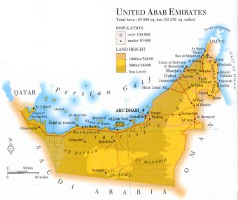
| location: Southwest Asia |
| time zone: +4 UT |
| surface (land) area: 83600 sq.km = 32280 sq.mi //; - area incl. inland waters: sq.km = sq.mi |
| geographical position in extreme co-ordinates: North: 27° N / South: 22° N / East: 57° E / West: 51° E |
| borders (land): Oman, Saudi Arabia, Qatar |
| borders (coastline): Persian Gulf (part of Indian Ocean) |
| climate: tropical arid |
| Government |
| independent since: 1971-12-02 |
| type of government: federation of emirates |
| capital: Abu Dhabi |
| administrative division: emirate (7) |
| Population |
| population according to the latest census (1995): 2377,453 |
| total population according to the estimate of midyear 2000: 2369,153; or: 2905,000 /-; 2001: 2407,460; or: 3042,000 |
| population density: 29 per sq.km = 74 per sq.mi |
| population growth: 7% //; - doubling time: 32 years |
| birth rate: 18 - 20 per 1000 |
| death rate: 4 per 1000 |
| fertility rate: 4 children per female |
| maternal mortality: per 100,000 |
| infant mortality (1-4 years): 18 per 1000 |
| life expectancy: 75 years (male: 72; female: 77) |
| age breakdown: 0-14 years: 31% //; - 15-59 years: 66% //; - 60+ years: 3% |
| urbanisation: 86% //; - urbanisation growth: 15% |
| percentage of urban population in the greatest city: % |
| Ethnic composition, language, religion |
| ethnic groups: diverse expatriats 45%; Arabs 25%; Iranian 17%; other Asian & African 8%; other 5% |
| languages: Arabic (official); English, Persian, Hindi, Urdu |
| religious affiliation: Muslim 96% (Sunnî 80%, Shî'î 16%); other (predominantly Christian and Hindu) 4% |
| Health |
| daily food intake: 3372 calories per capita |
| population with access to safe water: 98% |
| people per physician: 720 |
| people per hospital bed: |
| Education, literacy |
| school enrolment: primary education 6-11 years: 95% |
| school enrolment: secondary education: 17% |
| school enrolment: tertiary education 20-24 years: 6% |
| adult literacy: 79% (male: %; female: %) |
| Economy and infrastructure |
| Economy and trade |
| currency: UAE dirham = 100 fils |
| annual inflation rate: 2% |
| population below poverty line: % |
| Gross Domestic Product: USD 22470 per capita |
| GNI USD per capita //; - [ppp: ] |
| GDP growth: -2% |
| income: USD 19500 per capita |
| import: USD 17410 per capita //; - export: USD 24756 per capita |
| trade: USD 19745 per capita //; - or 120% of GDP |
| trade partners: JP GB US DE |
| human development index: 0,809 //; - position of the country in the world no.: 45 |
| female labour force: 15% |
| unemployment: 2% |
| tourism: 2,5 million |
| Economic activities in agriculture, fisheries, industry, mining, services, energy |
| land use: arable land: 0,5% //; - grass land: 2% //; - wooded area: 0% //; - arid land and desert: 97% |
| agriculture: labour force: 5% //; - part of agriculture in GDP: 2% |
| agricultural products: tomatoes, dates, eggplant, cabbages, lemons & limes, pumpkins & squash, vegetables |
| livestock (1000s): camels: 200 / cattle: 110 / goats:-1200 / poultry: 10700-14650 / sheep: 467 |
| fish catch: 114358 - 117600 metric tonnes |
| industry: labour force: 38% //; - part of industry in GDP: 55% |
| industrial products: cement, aluminium, food processing, petrochemicals |
| mining products: oil & natural gas, sulfur, gypsum, marble, shale for ceramic applications |
| CO2 emission per capita: 32,4 |
| services: labour force: 57% //; - part of services in GDP: 43% |
| energy use (kg per capita): 9997 |
| electricity use (per capita): 10643 |
| annual water use (per capita): 884 |
| Traffic, communication |
| road network: 4360, or 4835 km //; - of which paved: 100% //; - of which are motorways: 0 km |
| vehicles: 159 per 1000 |
| railways: 0 km //; - railways passenger/km: - |
| navigable inland waterways: 0 km |
| ownership telephone: 283 - 407 per 1000 |
| ownership radio receivers: 206 - 318 per 1000 |
| ownership tv-sets: 260 - 294 per 1000 |
| newspaper circulation: 126 per 1000 |
| persons per post office: 13200 |
| personal computers: 154 per 1000 |
| Some physical landmarks |
| mountains: nameless peak on the NE border with Oman 1934 m? ; Jabal Hafit 1189 |
| lowest point: sea level |
| lakes (natural): none |
| lakes (artificial reservoirs): none |
| lakes (deepest): unknown |
| rivers: some wadis |
| canals: none |
| waterfalls: none |
| caves: longest system: none / deepest: |
| islands: several in the Persian Gulf |
| deserts: at the edge of the Arabian desert Rub' al-Khâli |
| other natural features: |
| Additional remarks, especially on the statistical information |
| other important features: |
| apart from physical landmarks most of the above figures are changeable, in most cases they date from the 1990's |
| it is very difficult to discover specific information on maps concerning mountain names and tops |
| primary sources used for the general information: |
| BB CA EV PW WA WB WR, and some national statistical yearbooks |
| particulars concerning population data: |
 To the page containing the population growth statistics of the country
 To the page containing the historical population growth statistics of the provinces
 To the page containing urban historical population statistics
 Back to the homepage of this website: POPULATION STATISTICS
Internet website: Internet website:Latest modification of this page on 2004-03-13 by Jan Lahmeyer
© "populstat" site: Jan Lahmeyer