All countries of the world listed from A-Z:

or choose from the countries per continent below:


 |  |  |  |  |  |
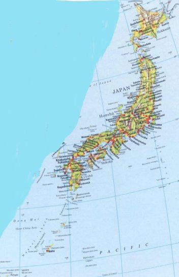 | JAPAN[Nihon ; Nippon] : |
| General useful information |
| Note: some data are of constant value, while other are due to changes, fluctuations etc. |
| Nation and population |
| official name (short form): Nihon ; Nippon |
| country code ISO: JP //; - FIPS: JA |
| location: East Asia |
| time zone: +9 UT |
| surface (land) area: 377835 [377880] sq.km = 145883 sq.mi //; - area incl. inland waters: sq.km = sq.mi |
| geographical position in extreme co-ordinates: North: 46° N / South: 21° N / East: 146° E / West: 122° E |
| borders (land): none |
| borders (coastline): Sea of Japan, Pacific Ocean // length of coastline: total 33889 km; only of the main islands: 19240 km |
| climate: various maritime |
| Government |
| independent since: ca. 660 BC ; 1868 |
| type of government: constitutional monarchy [empire] |
| capital: Tokyo |
| administrative division: region (9) into prefecture (46) and urban prefecture (2) and metropolis (1) |
| Population |
| population according to the last two censuses (1995): 125568,504 ; (2000): 126925,843 |
| total population according to the estimate of midyear 2000: 126549,976 // -; 2001: 127056,000 |
| population density: 336 per sq.km = 870 per sq.mi |
| population growth: 0,5% //; - doubling time: not applicable, exceeds 100 years |
| birth rate: 10 - 12 per 1000 |
| death rate: 8 per 1000 |
| fertility rate: 2 children per female |
| maternal mortality: 16 per 100,000 |
| infant mortality (1-4 years): 5 per 1000 |
| life expectancy: 81 years (male: 78; female: 84) |
| age breakdown: 0-14 years: 18% //; - 15-59 years: 64% //; - 60+ years: 17% |
| urbanisation: 79% //; - urbanisation growth: 2% |
| percentage of urban population in the greatest city: 22% |
| Ethnic composition, language, religion |
| ethnic groups: Japanese 99,1%; Korean 0,5%; Chinese 0,2%; other 0,2% |
| languages: Japanese; Korean, Chinese |
| religious affiliation: Shintoism and Buddhism 91%; Christian 1 - 8% |
| Health |
| daily food intake: 2874 calories per capita |
| population with access to safe water: 96% |
| people per physician: 509 |
| people per hospital bed: 76 |
| Education, literacy |
| school enrolment: primary education 6-11 years: 100% |
| school enrolment: secondary education: 96% |
| school enrolment: tertiary education 20-24 years: 31% |
| adult literacy: 100% (male: %; female: %) |
| Economy and infrastructure |
| Economy and trade |
| currency: Yen = 100 sen |
| annual inflation rate: 1,4% |
| population below poverty line: 11% |
| Gross Domestic Product: USD 29640 per capita |
| GNI USD 35620 per capita //; - [ppp: 27080] |
| GDP growth: 2,9% |
| income: USD 26920 per capita |
| import: USD 349186 per capita //; - export: USD 410947 per capita |
| trade: USD 4617 per capita //; - or 18% of GDP |
| trade partners: US DE SK SG GB IN AU |
| human development index: 0,928 //; - position of the country in the world no.: 9 |
| female labour force: 41% |
| unemployment: 5% |
| tourism: 4,8 million |
| Economic activities in agriculture, fisheries, industry, mining, services, energy |
| land use: arable land: 12% //; - grass land: 2% //; - wooded area: 67% //; - arid land and desert: % |
| agriculture: labour force: 7% //; - part of agriculture in GDP: 3% |
| agricultural products: rice, vegetables, timber, fish, sugar beets, fruits |
| livestock (million): cattle: 4,6 / goats: 0,03 / horses: 0,025 / pigs: 9,8 / poultry: 296 / sheep: 0,01 |
| fish catch: 5176460 - 6690000 metric tonnes |
| industry: labour force: 24% //; - part of industry in GDP: 42% |
| industrial products: iron & steel, electrical-, electronic equipment, cars, ships, textiles, chemicals, machinery |
| mining products: copper, gold, sulphur, natural gas, coal, lead |
| CO2 emission per capita: 9,0 |
| services: labour force: 69% //; - part of services in GDP: 55% |
| energy use (kg per capita): 4070 |
| electricity use (per capita): 7443 |
| annual water use (per capita): 735 |
| Traffic, communication |
| road network: 1136346 km //; - of which paved: 73% //; - of which are motorways: 6400 km |
| vehicles: 283 per 1000 |
| railways: 20134, or: 27327 km //; - railways passenger/km: 400058 |
| navigable inland waterways: 1770 km |
| ownership telephone: 488 per 1000 |
| ownership radio receivers: 801 per 1000 |
| ownership tv-sets: 619 per 1000 |
| newspaper circulation: 576 per 1000 |
| persons per post office: 5090 |
| personal computers: 315 per 1000 |
| Some physical landmarks |
| mountains: Fuji-san 3776 m, Kita-dake (Shirane-san) 3192, Okuhotaka-dake (Hodaka-dake) 3190, Aino-take 3189, Yariga-take 3180 |
| lowest point: sea level |
| lakes (natural): Biwa-ko 670 sq.km, Kasumiga-ura 168, Saroma-ko 152, Inawashiro-ko 103, Naka-umi 86, Kussharo-ko 79, Shinji-ko 79, Shikotsu-ko 78 |
| lakes (artificial reservoirs): some small ones |
| lakes (deepest): unknown |
| rivers: Shinano-gawa 367 km, Tone-gawa 322, Ishikari-gawa 268; and many shorter ones to drain the mountains |
| canals: unknown |
| waterfalls: Kegon 100 m |
| caves: longest system: unknown / deepest: |
| (main) islands: Honshu, Hokkaido, Kyushu, Shikoku, Etorofu, Kunashiri, Okinawa, Nansei-shoto |
| deserts: none |
| other natural features: some volcanic activity and earthquake danger |
| Additional remarks, especially on the statistical information |
| other important features: |
| apart from physical landmarks most of the above figures are changeable, in most cases they date from the 1990's |
| primary sources used for the general information: |
| BB CA EV PW WA WB WR, and some national statistical yearbooks |
| particulars concerning population data: |
 To the page containing the population growth statistics of the country
 To the page containing the historical population statistics of the actual administrative division
 To the page containing historical population statistics of the former administrative division
To the page containing urban historical population statistics
 Back to the homepage of this website: POPULATION STATISTICS
Internet website: Internet website:Latest modification of this page on 2004-02-20 by Jan Lahmeyer
© "populstat" site: Jan Lahmeyer