All countries of the world listed from A-Z:

or choose from the countries per continent below:


 |  |  |  |  |  |
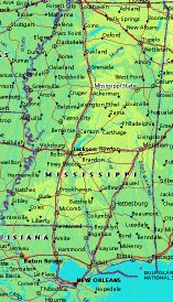 | UNITED STATES OF AMERICA : MISSISSIPPI
|
| General useful information |
| Note: some data are of constant value, while other are due to changes, fluctuations etc. |
| State and population |
| capital: Jackson // state code ISO: MS ; FIPS: US29 |
| surface: 121510 sq.km = 46916 sq.mi // rank in USA: 31 // location: East South Central |
| climate: semi-tropical, with abundant rainfall, long growing season, extreme temperatures unusual |
| entered USA as 20th state on: 1817-12-10 |
| administrative division: 82 counties |
| total population according to the census of 2000: 2,844,658 |
| population density 2000: 23 per sq.km = 61 per sq.mi // net growth 1999-2000: 10,5% |
| main ethnic groups: white 61,4%; black 36,3%; other 2% |
| Economy and infrastructure |
| chief crops: cotton, rice, soybeans |
| livestock (million): cattle: 1,1 / pigs: ,0315 / poultry: 10,3 ; broilers 735,1 |
| timber/lumber: pine, oak, hardwoods |
| chief industries: warehousing & distribution, services, manufacturing, government, wholesale & retail trade |
| chief industrial products: chemicals & plastics, food & kindred products, furniture, lumber & wood products |
| chief mining products: sand & gravel, portland cement, clays, dimension stone |
| Some physical landmarks |
| highest point in the state: Woodall Mt. 246 m = 806 ft |
| other mountains: hardly of importance |
| lowest point in the state: sea level |
| lakes: Lake Bogue Homo; if there are more natural lakes, they are hardly recognisable on maps |
| artificial lakes: Ross Barnett Res., Sardis Lake, Arkabutla L., Grenada L., Okatibbee L., Enid L., Pickwick L. |
| rivers: Mississippi, Yazoo, Pearl, Big Black, Pascagoula, Tombigbee |
| others: islands: Cat Island, Ship Island, Horn Island, Petit Bois Island // deserts: none |
| Additional remarks, especially on the statistical information |
| other important features: |
| nick name(s): Magnolia State |
| motto: Virtute et Armis (By valor and arms) |
| song: Go, Mississippi! |
| flower: Magnolia // bird: Mockingbird // tree: Magnolia |
| primary sources: |
| World almanac and book of facts; National Geographic Atlas of the World; maps: WN world @tlas |
 Back to the page containing general information of the whole country
 To the page containing the population growth statistics of the whole country
 to the secondary administrative division of the state
To the page containing historical population statistics of some important towns of the state
To the page containing urban historical population statistics of the whole country
 Back to the homepage of this website: POPULATION STATISTICS
File created on 2003.03.02 by Jan Lahmeyer
© "populstat" site: Jan Lahmeyer