All countries of the world listed from A-Z:

or choose from the countries per continent below:


 |  |  |  |  |  |
 | RÉUNIONgeneral data of the country |
| General useful information |
| Note: some data are of constant value, while other are due to changes, fluctuations etc. |
| Nation and population |
| official name (short form): Réunion |
| country code ISO: RE //; - FIPS: RE |
| location: Southeast Africa |
| time zone: +4 UT |
| surface (land) area: 2507 sq.km = 968 sq.mi //; - area incl. inland waters: sq.km = sq.mi |
| geographical position in extreme co-ordinates: North/South: 21° S / East/West: 56° E |
| borders (land): none |
| borders (coastline): Indian Ocean |
| climate: tropical oceanic/monsoon |
| Government |
| independent since: not yet |
| type of government: overseas department of France since 1665 |
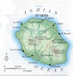
| capital: Saint-Denis |
| administrative division: arrondissement (4) into commune (24) |
| Population |
| population according to the latest census (1999): 706,300 |
| total population according to the estimate of midyear 2000: 720,934 /-; 2001: 732,570 |
| population density: 288 per sq.km = 745 per sq.mi |
| population growth: 1,7% //; - doubling time: years |
| birth rate: 20 per 1000 |
| death rate: 5 per 1000 |
| fertility rate: 2 children per female |
| maternal mortality: per 100,000 |
| infant mortality (1-4 years): 12 per 1000 |
| life expectancy: 72 years (male: 68; female: 76) |
| age breakdown: 0-14 years: 32% //; - 15-59 years: 61% //; - 60+ years: 8% |
| urbanisation: 64% //; - urbanisation growth: % |
| percentage of urban population in the greatest city: % |
| Ethnic composition, language, religion |
| ethnic groups: mixed 64%; East Indian 28%; Chinese 2%; white 2%; East African 1%; other 3% |
| languages: French (official); Creole |
| religious affiliation: Roman Catholic 92%; Muslim 1% |
| Health |
| daily food intake: calories per capita |
| population with access to safe water: % |
| people per physician: 525 |
| people per hospital bed: 254 |
| Education, literacy |
| school enrolment: primary education 6-11 years: % |
| school enrolment: secondary education: % |
| school enrolment: tertiary education 20-24 years: % |
| adult literacy: 69% (male: %; female: %) |
| Economy and infrastructure |
| Economy and trade |
| currency: Euro = 100 cents (until 2002: Franc = 100 centimes) |
| annual inflation rate: 1,6% |
| population below poverty line: % |
| Gross Domestic Product: USD per capita |
| GNI USD per capita //; - [ppp: ] |
| GDP growth: % |
| income: USD 6000 per capita |
| import: USD 2711 per capita //; - export: USD 209 per capita |
| trade: USD 3736 per capita //; - or % of GDP |
| trade partners: FR BE DE IT JP ZA |
| human development index: //; - position of the country in the world no.: |
| female labour force: 43% |
| unemployment: % |
| tourism: 0,4 million |
| Economic activities in agriculture, fisheries, industry, mining, services, energy |
| land use: arable land: 21% //; - grass land: 56% //; - wooded area: 35% //; - arid land and desert: % |
| agriculture: labour force: 10% //; - part of agriculture in GDP: 6% |
| agricultural products: sugar cane, vanilla, rum, tobacco, ginger, pimento, pineapple, bananas, tomatoes, vetiver |
| livestock (in 1000s): cattle: 28 / goats: 38 / pigs: 76 / poultry: 12700 / sheep: 2 |
| fish catch: 5800 metric tonnes |
| industry: labour force: 5% //; - part of industry in GDP: 17% |
| industrial products: food products, mainly sugar refining |
| mining products: of no importance |
| CO2 emission per capita: |
| services: labour force: 85% //; - part of services in GDP: 77% |
| energy use (kg per capita): 669 |
| electricity use (per capita): |
| annual water use (per capita): |
| Traffic, communication |
| road network: 2754 km //; - of which paved: 79% //; - of which are motorways: 0 km |
| vehicles: 330 per 1000 |
| railways: 0 km //; - railways passenger/km: - |
| navigable inland waterways: 0 km |
| ownership telephone: 329 - 347 per 1000 |
| ownership radio receivers: 257 - 265 per 1000 |
| ownership tv-sets: 189 - 205 per 1000 |
| newspaper circulation: 83 per 1000 |
| persons per post office: |
| personal computers: per 1000 |
| Some physical landmarks |
| mountains: Piton des Neiges 3069 m, Le Gros Morne 2992, Grande Bénare 2896, Volcan de la Fournaise 2625, Nez de Boeuf 2136 |
| lowest point: sea level |
| lakes (natural): Grand Etang |
| lakes (artificial reservoirs): none, or unknown |
| lakes (deepest): Grand Etang (?) |
| rivers: some small rivers to drain the mountain slopes, such as Rivière du Mât, Rivière des Remparts |
| canals: none, or unknown |
| waterfalls: none, or unknown |
| caves: longest system: none, or unknown / deepest: |
| islands: for adjacent islands see the separate file of the administrative division |
| deserts: none |
| other natural features: |
| Additional remarks, especially on the statistical information |
| other important features: |
| apart from physical landmarks most of the above figures are changeable, in most cases they date from the 1990's |
| primary sources used for the general information: |
| BB CA EV PW WA WB WR, and some national statistical yearbooks |
| particulars concerning population data: |
 To the page containing the population growth statistics of the country
 To the page containing the historical population growth statistics of the provinces
 To the page containing urban historical population statistics
 Back to the homepage of this website: POPULATION STATISTICS
Internet website: For more figures of FranceLatest modification of this page on 2004-03-03 by Jan Lahmeyer
© "populstat" site: Jan Lahmeyer