All countries of the world listed from A-Z:

or choose from the countries per continent below:


 |  |  |  |  |  |
 | LIBERIAgeneral data of the country |
| General useful information |
| Note: some data are of constant value, while other are due to changes, fluctuations etc. |
| Nation and population |
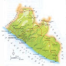
| official name (short form): Liberia |
| country code ISO: LR //; - FIPS: LI |
| location: West Africa |
| time zone: +0 UT |
| surface (land) area: 99065 sq.km = 38250 sq.mi //; - area incl. inland waters: sq.km = sq.mi |
| geographical position in extreme co-ordinates: North: 8° N / South: 4° N / East: 7° W / West: 11° W |
| borders (land): Sierra Leone, Guinea, Côte d'Ivoire |
| borders (coastline): Atlantic Ocean |
| climate: tropical |
| Government |
| independent since: 1847-07-26 |
| type of government: republic |
| capital: Monrovia |
| administrative division: county (13) |
| Population |
| population according to the latest census (1984): 2101,628 |
| total population according to the estimate of midyear 2000: 3164,156; or: 3130,000 / -; 2001: 3226,000 |
| population density: 32 per sq.km = 82 per sq.mi |
| population growth: 2,8% //; - doubling time: 23 years |
| birth rate: 46 - 47 per 1000 |
| death rate: 14 - 16 per 1000 |
| fertility rate: 6 children per female |
| maternal mortality: 173 per 100,000 |
| infant mortality (1-4 years): 113 per 1000 |
| life expectancy: 51 years (male: 50; female: 53) |
| age breakdown: 0-14 years: 45% //; - 15-59 years: 49% //; - 60+ years: 6% |
| urbanisation: 44% //; - urbanisation growth: 6% |
| percentage of urban population in the greatest city: % |
| Ethnic composition, language, religion |
| ethnic groups: Kpelle 19 - 20%; Bassa 14%; Grebo 9%; Gio 8%; Kru 7%; Mano 7%; Loma 6%; Americo-Liberians 2,5% |
| languages: English (official); Mande, West Atlantic, Kwa |
| religious affiliation: Christian 10 - 68%; Muslim 14 - 20%; traditional beliefs 18 - 70% |
| Health |
| daily food intake: 1979 calories per capita |
| population with access to safe water: 30% |
| people per physician: 9340 |
| people per hospital bed: |
| Education, literacy |
| school enrolment: primary education 6-11 years: 75% |
| school enrolment: secondary education: 67% |
| school enrolment: tertiary education 20-24 years: 22% |
| adult literacy: 39% (male: %; female: %) [later total figure found: 53%] |
| Economy and infrastructure |
| Economy and trade |
| currency: Liberian dollar = 100 cents |
| annual inflation rate: % |
| population below poverty line: % |
| Gross Domestic Product: USD 430 per capita |
| GNI USD per capita //; - [ppp: ] |
| GDP growth: % |
| income: USD 600 per capita |
| import: USD 5760 per capita //; - export: USD 389 per capita |
| trade: USD 285 per capita //; - or % of GDP |
| trade partners: SA US DE NL IT FR |
| human development index: //; - position of the country in the world no.: [no actual position known] |
| female labour force: 40% |
| unemployment: % |
| tourism: 0 million |
| Economic activities in agriculture, fisheries, industry, mining, services, energy |
| land use: arable land: 4% //; - grass land: 59% //; - wooded area: 18% //; - arid land and desert: % |
| agriculture: labour force: 74% //; - part of agriculture in GDP: 39% |
| agricultural products: natural rubber, coffee, timber, cocoa, rice, cassava, sugar |
| livestock (1000s): cattle: 36 / goats: 220 / pigs: 130 / poultry: 3500-4200 / sheep: 210 |
| fish catch: 15472 metric tonnes |
| industry: labour force: 9% //; - part of industry in GDP: 28% |
| industrial products: rubber & palm oil processing, forestry, fishing |
| mining products: iron ore, diamonds, gold, barytes, kyanite, columbite, manganese |
| CO2 emission per capita: 0,1 |
| services: labour force: 16% //; - part of services in GDP: 35% |
| energy use (kg per capita): 169 |
| electricity use (per capita): |
| annual water use (per capita): 56 |
| Traffic, communication |
| road network: 5412, or 10600 km //; - of which paved: 6% //; - of which are motorways: 0 km |
| vehicles: 1 per 1000 |
| railways: 493 km //; - railways passenger/km: ? |
| navigable inland waterways: 0 km |
| ownership telephone: 2 per 1000 |
| ownership radio receivers: 263 - 275 per 1000 |
| ownership tv-sets: 20 - 29 per 1000 |
| newspaper circulation: 14 per 1000 |
| persons per post office: |
| personal computers: per 1000 |
| Some physical landmarks |
| mountains: Mount Nimba 1768 m, Niete (Putu Range) 700 |
| lowest point: sea level |
| lakes (natural): Lake Piso |
| lakes (artificial reservoirs): none, or unknown |
| lakes (deepest): unknown |
| rivers: Mano, Lof(f)a, Saint Paul, Saint John, Cess (Cestos), Cavalla |
| canals: none, or unknown |
| waterfalls: none, or unknown |
| caves: longest system: none, or unknown / deepest: |
| islands: none, or unknown |
| deserts: none |
| other natural features: |
| Additional remarks, especially on the statistical information |
| other important features: |
| apart from physical landmarks most of the above figures are changeable, in most cases they date from the 1990's |
| due to civil war conditions in the last years some figures are not very recent |
| primary sources used for the general information: |
| BB CA EV PW WA WB WR, and some national statistical yearbooks |
| particulars concerning population data: |
 To the page containing the population growth statistics of the country
 To the page containing the historical population growth statistics of the provinces
 To the page containing urban historical population statistics
 Back to the homepage of this website: POPULATION STATISTICS
Internet website:Latest modification of this page on 2004-02-22 by Jan Lahmeyer
© "populstat" site: Jan Lahmeyer